Faro de la Entallada

Tuineje, Canarias, Spain
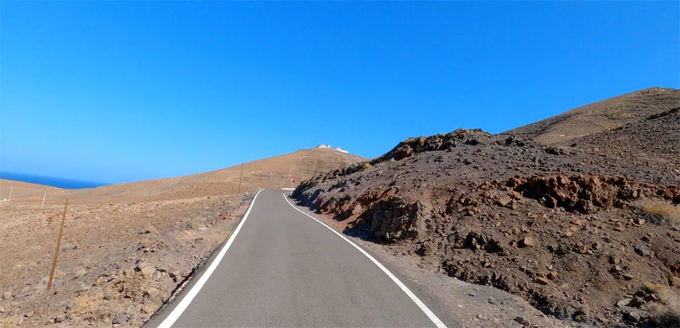
 Faro de la Entallada
Distance: 13.22 km
Elevation Gain: 266 m
Elevation Loss: 118 m
Difficulty:
226 (Easy)
FIETS Index: 0.30 FIETS
Avg Grade: 1.71 %
Max cat climb: 3
Min elevation: 10 m
Max elevation: 184 m
Ride Category:
Hilly
This short ride runs along the south-east coast of Fuerteventura, in the Canary Islands, Spain, to the Faro de La Entallada on its headland. The lighthouse was lit on 3 December 1954, and its light shines from 196 m above the sea, on an island just 97 km from the coast of Africa.
The ride starts above Gran Tarajal and drops to the coast, then crosses the hills past Las Playitas, a resort where European triathletes come for training camps and where the Challenge Fuerteventura half-ironman is held. From there the road climbs to the headland, with its steepest part at the end, and the ride finishes at the lighthouse’s square stone tower.
| Rank | Rider | Date | Time | Power | W/kg | Speed |
|---|---|---|---|---|---|---|
| 🥇 | Tom Smeets | Nov 13, 2024 | 00:25:55 | 297 W | 4.07 w/kg | 30.62 km/h |
| 🥈 | Gunnar Tojren | Oct 22, 2024 | 00:26:15 | 301 W | 3.91 w/kg | 30.23 km/h |
| 🥉 | Sebastian Meyer zu Selhausen | Mar 14, 2025 | 00:26:41 | 313 W | 3.56 w/kg | 29.74 km/h |
| 4 | D Speelman | Jan 22, 2025 | 00:27:21 | 269 W | 3.45 w/kg | 29.01 km/h |
| 5 | Rainer Klee | Jan 28, 2025 | 00:27:35 | 279 W | 3.38 w/kg | 28.77 km/h |
| 6 | Tristan Kramers | Feb 02, 2025 | 00:28:35 | 238 W | 3.31 w/kg | 27.76 km/h |
| 7 | Rene van Leeuwen | Feb 06, 2025 | 00:30:19 | 240 W | 2.89 w/kg | 26.17 km/h |
| 8 | Valentin Lahaye | Oct 23, 2025 | 00:30:20 | 196 W | 3.32 w/kg | 26.16 km/h |
| 9 | Geir Skaugen | Apr 27, 2026 | 00:30:24 | 241 W | 2.84 w/kg | 26.10 km/h |
| 10 | gert-jan achterberg | Feb 09, 2025 | 00:30:47 | 222 W | 3.08 w/kg | 25.78 km/h |
Users who liked this also liked
| Ride Name | Dist (km) | Elev (m) | Diff | Pop | Rating |
|---|---|---|---|---|---|
| Volcano Atalaya de Fémes | 10.93 | 343 | 1.92 | 88 | 4.53 |
| Golte Mountain (gravel) | 8.77 | 421 | 1.98 | 91 | 4.62 |
| Black Mountain Pass (Brecon Beacons) | 17.00 | 457 | 1.25 | 98 | 4.56 |
| Montana Carbon (East side) | 20.36 | 215 | 0.43 | 145 | 4.45 |
| Fan Gyhirych (Brecon Beacons) | 17.32 | 224 | 0.68 | 198 | 4.45 |